Enhanced Maritime Situational Awareness
This page has been archived
Information identified as archived is provided for reference, research or recordkeeping purposes. It is not subject to the Government of Canada Web Standards and has not been altered or updated since it was archived. Please contact us to request a format other than those available.
The Government of Canada is developing a new maritime awareness information system.
This system will provide Indigenous Peoples, coastal communities and marine partners with vessel traffic data and access to local maritime information. The system will be user-friendly and will provide information in real time.
The system could include:
- weather information, including sea and ice conditions
- tidal and underwater current information
- vessel information from terrestrial Automatic Identification Systems (AIS) data
- vessel information from space-based AIS (satellites) data
- historical vessel position information
- information on ecologically sensitive areas
- traditional and cultural knowledge
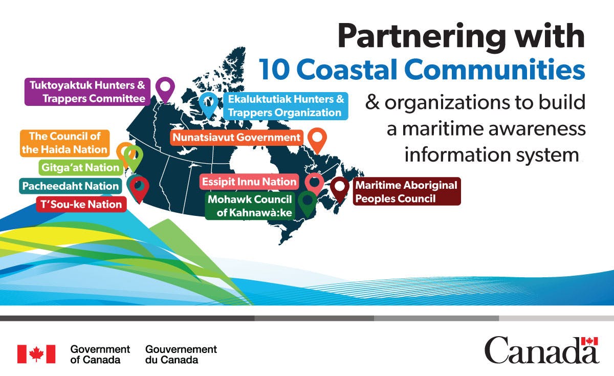
We are partnering with 10 Indigenous communities across Canada to test and evaluate the system. This will happen through one-year pilot projects, beginning in spring 2019. These pilot projects are an opportunity for partners to give us feedback, and will help to improve and update the system.
To learn more and share your ideas:
- Read the maritime awareness information system fact sheet(External link)
- View a map showing our pilot project partners
- Click Register” at the top of the page, or sign in
- Send a formal written submission via the “Submissions” tab
Signup Banner